
Parque de campismo
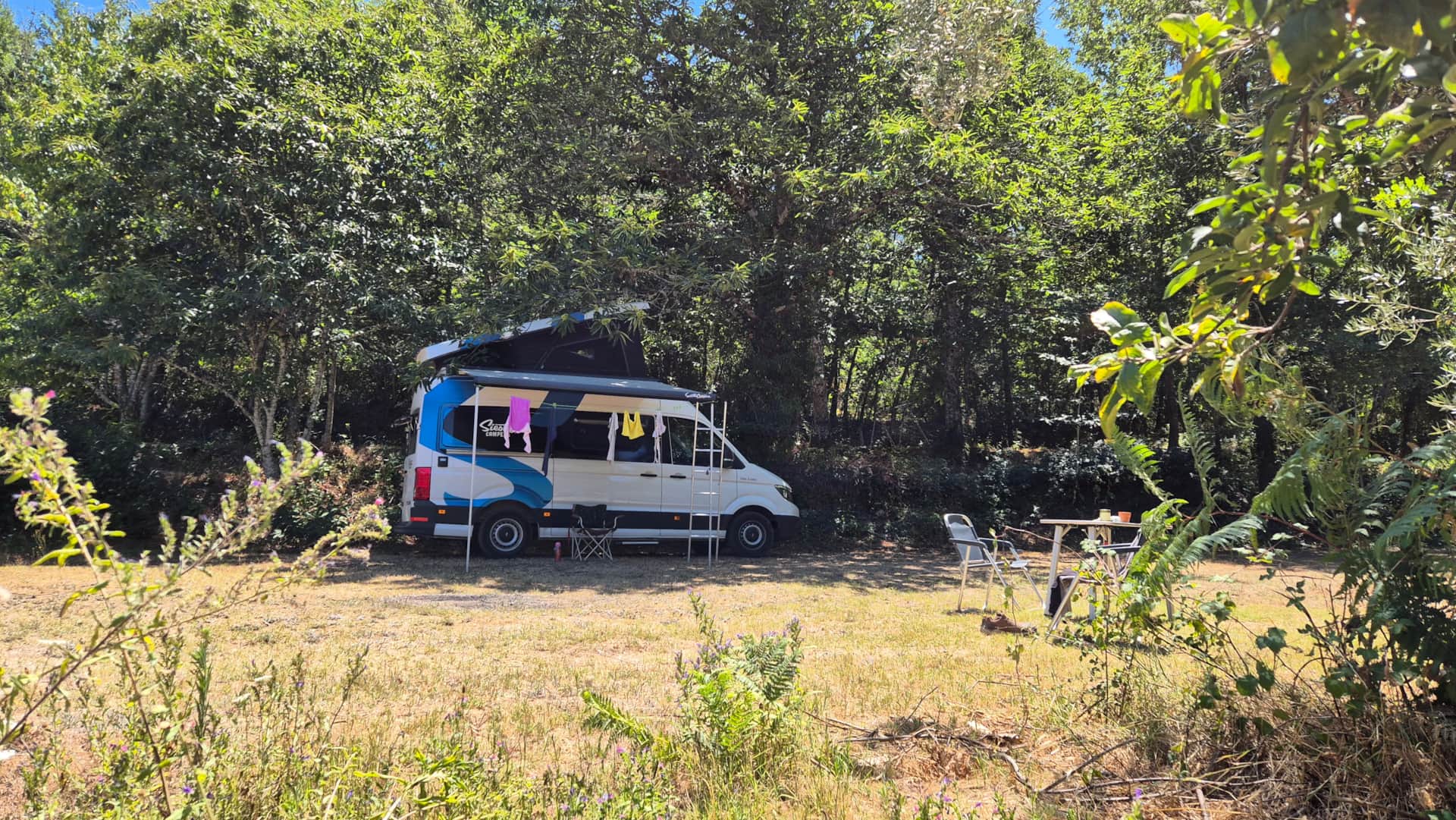
Acampamento Chestnut Field 1
- 5 pessoas
Espaçoso local para acampamento (75 m²) com vista para o nosso vinhedo. Adequado para barracas, vans e autocaravanas (máx. 7,5 metros). Se você chegar com uma autocaravana, selecione esta opção nas configurações da reserva.
Existe uma ligação elétrica de 6 amperes disponível para este local. Se desejar utilizá-la, selecione esta opção nas configurações da reserva.
Não dispomos de casa de banho química no parque de campismo, mas existe uma a apenas 5 km de distância, na aldeia de Penalva do Castelo. Clique aqui para ver a localização.
Nosso acampamento está lindamente situado nas colinas, mas isso significa que um trecho da estrada dentro da propriedade tem uma inclinação bastante acentuada para cima.
Fotos
Serviços
Piscina e spa
Piscina exterior não aquecida comum
Entretenimento
Matraquilhos, Mesa de ping-pong
Características da localização
Rural
Regras da Casa
Animais de estimação não permitidos
- Chegada03:00 PM
- Partida11:00 AM
Localização
Quinta sa Silva - Lugar do Pisao 1, Penalva do Castelo, Penalva do Castelo, Portugal
Car/motorcycle or small camper
Preferably follow these coordinates: 40°39'18.6"N 7°43'59.0"W or the map link .
From Mangualde, drive via the N329 towards Penalva do Castelo. At coordinates 40.652658''N, -7.733168''W , turn left before the bend . Follow this road downhill, and after the bend to the left, you will see the entrance to the campsite.
Are you coming from Penalva do Castelo? Then do not take the first exit before the bend to the right, but the second exit after the bend.
From the main road, you can follow the signs to the campsite.
Camper and/or caravan
From Mangualde, drive towards Penalva do Castelo.
After the yellow bridge (GPS: 40.645364''N, -7.734883''W) , turn sharply left (in the bend) and then follow the signs for the village of Casal Diz / Pindo.
You drive along the Dão river and then turn right through the village, past the small church (Capela de Senhora da Ribeira). Continue along the road and cross the bridge (GPS: 40.652684''N, -7.738702''W) and go left uphill into the next village (Moinhos de Pepim). At Rua Escola (past the trash cans), follow the road to the right (GPS: 40.653700''N, -7.740609''W ).
Follow this road until you see the sign "Qta do Logor", then turn right. GPS: 40.659142"N 7.742122"W .
Then drive on and cross the yellow bridge (Coja River). Next, take the first exit to the right and you can continue driving to the green gate of the campsite.
- 157 KmAeroporto
- 10 KmÔnibus
- 6 KmRodovia
- 10 KmTrem
- 112 KmPorto

Taxas
Política e notas
Cronograma de pagamento
100% do valor total deverá ser pago no momento da reserva.
Valor restante: A vencer posteriormente
Política de cancelamento
Todos pagamentos antecipados já realizados não são reembolsáveis.
Depósito de fiança
Não há depósito de fiança a vencer.
Disponibilidade
Selecione a data de check-in
| domingo | segunda | terça | quarta | quinta | sexta | sábado |
|---|---|---|---|---|---|---|
30 | 31 | 1 | 2 | 3 | 4 | 5 |
6 | 7 | 8 | 9 | 10 | 11 | 12 |
13 | 14 | 15 | 16 | 17 | 18 | 19 |
20 | 21 | 22 | 23 | 24 | 25 | 26 |
27 | 28 | 29 | 30 | 1 | 2 | 3 |
Opiniões
Sobre o anfitrião
Entrar em contato
- Email:[email protected]
- Telefone:+31615962716
- Site web:https://campingvalesereno.com